Marine Parks and No-Take Zones Across Australia
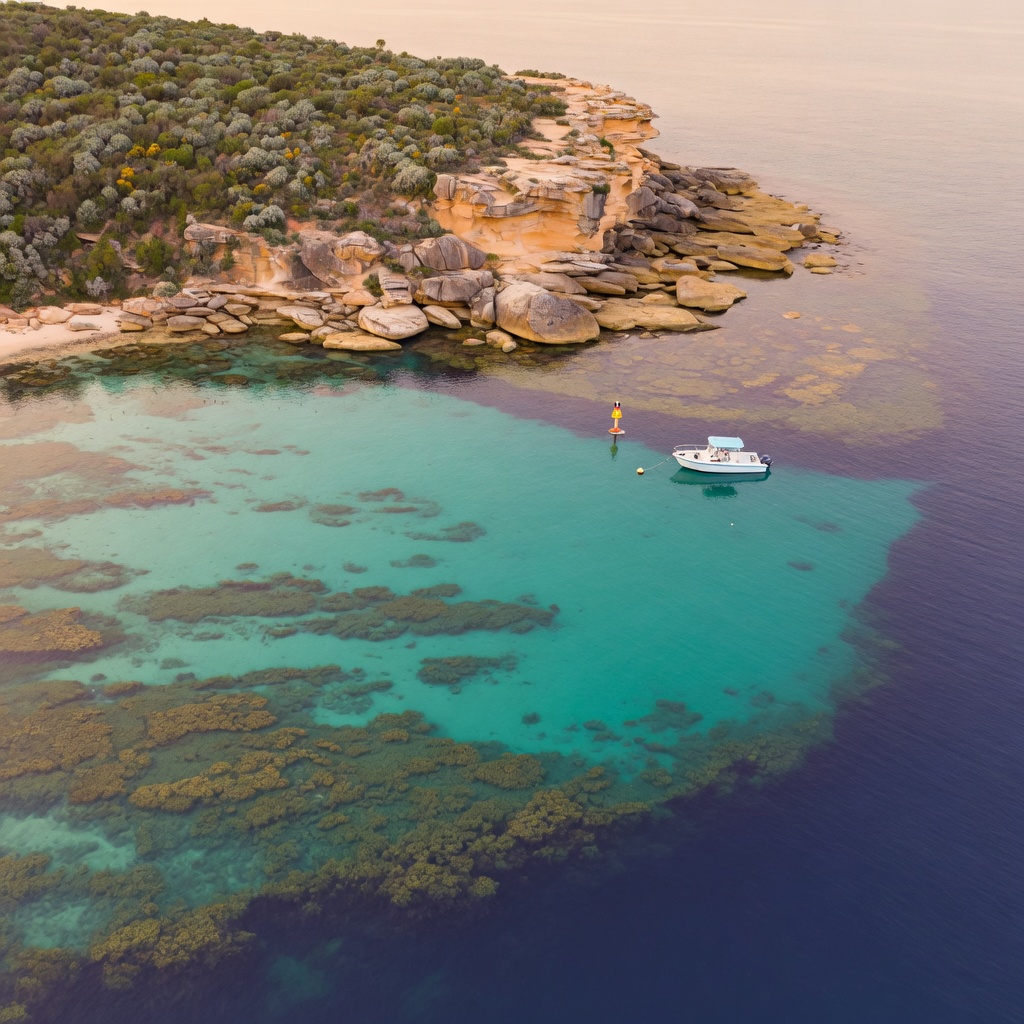
Why Zoning Matters as Much as Your Licence
Holding a valid recreational fishing fee or permit does not automatically grant you the right to fish everywhere. Across Australia, thousands of kilometres of coastline and many inland waters sit inside marine parks, aquatic reserves, sanctuary zones and intertidal protected areas. In these places, the rules are set by location rather than by species, and penalties can apply even when you are using legal gear and keeping fish within bag and size limits.
Fishing Licence Australia exists to help anglers understand that second layer of regulation. If you fish around Sydney, the harbour, the northern beaches, Botany Bay and the coastal rock platforms all include areas with different levels of protection. Learning to read a zoning map is one of the most useful skills a recreational angler can develop.
How Marine Park Zoning Generally Works
Zone names differ between jurisdictions, but the concepts are broadly similar across Commonwealth and state waters:
- Sanctuary or no-take zones — the highest level of protection. All fishing, collecting and spearfishing is generally prohibited, including taking bait, shellfish and worms. You may usually transit, swim, snorkel or dive, but gear should be stowed and unbaited.
- Habitat protection zones — some recreational fishing is often allowed, while methods that disturb the seabed may be restricted.
- General use zones — most standard recreational fishing is permitted, subject to normal bag limits, size limits and gear rules.
- Special purpose zones — narrow rules for a defined activity or area, such as a single boat ramp channel, a research site or a seasonal aggregation area.
- Intertidal protected areas and aquatic reserves — commonly used near cities to protect rock platforms, seagrass beds and estuary nursery habitat from bait collecting.
Because names are not standardised nationally, never assume that a zone label you learned in Queensland carries the same permissions in New South Wales, Victoria, South Australia, Western Australia, Tasmania or the Northern Territory.
Boundaries: The Part Most Anglers Get Wrong
Most compliance issues in protected areas come down to position, not intent. A few habits reduce that risk considerably:
- Check the official zoning map for the specific waterway before you leave home, not once you are drifting.
- Save boundary waypoints into your GPS or chartplotter and add a buffer of at least a hundred metres where a line runs close to a productive mark.
- Note that boundaries are often described by coordinates or by landmarks such as a headland, navigation marker or a line between two points — visual estimates from a small boat can be badly wrong.
- Remember that drifting counts. If your bait sits in a no-take zone while your boat sits outside it, you are fishing in the zone.
- Watch for signage at boat ramps, jetties and beach access tracks, which usually summarises local restrictions.
Sydney and Coastal New South Wales
The greater Sydney region contains a mix of aquatic reserves and protected rock platforms in addition to the broader marine park network further north and south along the coast. Typical local restrictions include bans on collecting cunjevoi, worms, cabbage and shellfish from certain platforms, no-take areas around some headlands and bays, and limits on spearfishing in enclosed waters. Estuary sections may also be closed to protect seagrass or juvenile fish habitat.
Anglers visiting for a weekend should treat each waterway separately: harbour rules, offshore rules and lake or lagoon rules can all differ within a short drive. For an overview of licences, permits and general regulations that apply alongside these zone rules, start from the Fishing Licence Australia homepage.
Protected Species Inside and Outside Parks
Zoning is only one form of protection. Certain species remain fully protected wherever you fish, including some sharks, rays, seahorses, handfish, groper populations in defined areas and various threatened freshwater species. Marine mammals, turtles and seabirds must not be targeted or harassed, and hooked birds should be handled carefully and reported where required. If you cannot identify a fish confidently, releasing it quickly and gently is always the safer choice.
Freshwater Reserves and Closures
Inland anglers face their own set of area-based rules: closed waters around dam walls and water supply infrastructure, trout stream closures during spawning periods, and reserves protecting endangered native fish. Some impoundments also restrict boating, engine use or bait types. Seasonal closures change from year to year, so check the current season dates rather than relying on last year's plan.
Practical Pre-Trip Checklist
- Confirm your recreational fishing fee, permit or exemption is current for the state you are visiting.
- Download or print the relevant marine park and reserve zoning map for the exact area.
- Record bag limits, size limits and any total-length measuring rules for your target species.
- Check for temporary closures, spawning restrictions and gear bans on the official fisheries site for that jurisdiction.
- Carry a measuring device, keep catch identifiable, and store gear unbaited while transiting no-take zones.
Getting Help
Rules are updated regularly, and the official state and Commonwealth fisheries agencies remain the authoritative source for boundaries, dates and limits. If you are unsure how a zone applies to a spot you plan to fish, contact Fishing Licence Australia at [email protected] or +61250701250 during Mon–Fri: 09:00 – 17:00 (AEST) and we will point you to the correct official map or regulation for your area.
Navigation
See also
FAQ